
Rosecrans Field
Airfield Identification
 1939 to present
United States of America
CITY: St Joseph, MO
IATA/ICAO CODES: STJ / KSTJ
COORDINATES: 39°46'N / 94°55'W
OTHER NAMES: Rosecrans Field (WWII), Rosecrans ANGB (present), Rosecrans Memorial (present)
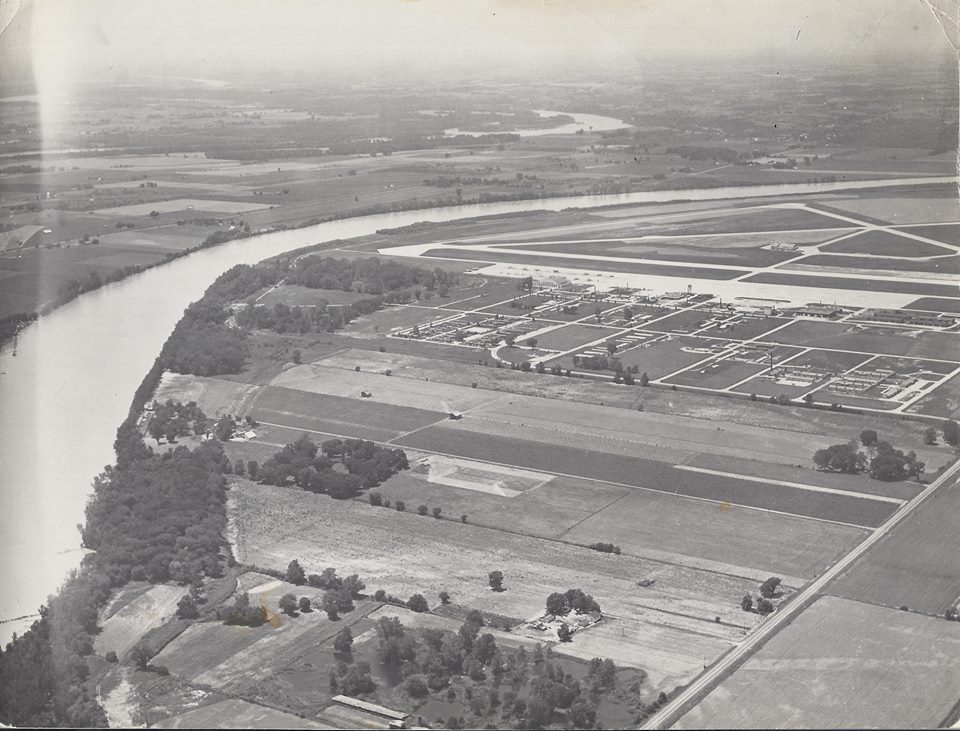
Right: Rosecrans Field before the Great Flood of 1951 changed the course of the Missouri River.
Photo credit: unknown
Commando Operations
Rosecrans is located on a field which was once better known as the “French Bottoms.” The northern part of the French Bottoms was settled in the 1830’s, and has since washed away due to the many floods over the years. The area was aptly named as the original settlers were French descendants. The airfield gets its name from the only St Joseph airman killed during World War I, Sgt Guy Wallace Rosecrans.
The rich Missouri River soil, totaling about 5,000 acres, was traditionally used for farming and there are still some seasonal crops surrounding the airfield. The first Rosecrans Field was founded in 1922 at Lake Contrary with the second version located on waterworks road. This location was short-lived, due to the modest size and its dangerous closeness to the Missouri River bluffs. It was clear that a new location for a growing aviation base was needed.
The new Rosecrans was built in 1939 airport as a true municipal airport. Two 3,000-foot long runways were poured together with an aircraft hangar located east of the runway intersection. The government created an Army Air Base in St Joseph with numerous enhancements being made during World War II between 1942 and 1943. The angled runways were doubled in length and a 5,500-foot north-south runway added, while the apron and many temporary buildings, including Hangar T-1020, were built. Rosecrans Field became a major Commando operation center, as it was home to the Air Transport Command's 1st Operational Training Unit (1 OTU). It later also housed the 3rd Operational Training Unit (3 OTU) before it moved to Reno AAF, NV.
The Great Flood of 1951 damaged many “temporary” World War II airport buildings beyond economic repair. The Missouri River changed course during this flooding, cutting off the airport from its physical property connection to the city of St Joseph, MO. The Missouri River cutoff the city from the airport. The Great Flood of 1993 ruined many aircraft, the “Cockpit Cafe” as well as the City Administration Building. Both were reconstructed in due time. After the water receded, work went into reconstructing the landing strip for the Air National Guard Runway 13-31 in 1994. Further improvements were completed by adding a VFR runway for small aviation aircraft, a new hangar as well as a fresh fixed base operator building were also built. The main use of the airport now is as base for the 139th Airlift Wing of the Missouri Air National Guard.
Units & operators based
559th & 561st AAF Base Unit (Rosecrans AAF)
1st Operational Training Unit (1 OTU)
3rd Operational Training Unit (3 OTU) (1942 to June 1943)
Last edited: 28/10/2022